May 15, 2012
Beyond the Reference: Continuity, Memory and Territory in Cartographic Art
By Brian Brush
Contemporary artwork which interprets, borrows, reconstitutes, manipulates, or is generally inspired by maps and mapping often depends significantly on the works’ ability to transmit a reference geography visually and symbolically through the art. Glancing through collections of cartographic art such as “The Map as Art” (1), a broad survey of recent map art edited by Katharine Harmon, one is met with works which, regardless of artistic medium, frequently defer to an actual map of a particular place, unless the subject is non-geographic. These works explore maps through devices such as translation by color, texture, text, and material, or through geometric arrangement and distortion, but ultimately present a readable map that inhabits the structure of the work and is the final counterpoint to the artistic content. The prevalence of this tendency seems to suggest that accepted cartographic artistic practice must begin or end with a perceivable, real geographic reference. This limits the exploratory potential of cartographic art to the carto-symbolic known. Does inclusion of a distinguishable visual reference validate cartographic art? Can cartographic art exist without inclusion of some existing representation of place which, although manipulated visually, is recognizable by the audience? If so, what is the role of the map – is it simply a muse? A palimpsest? A relic?
The problem with this carto-symbolic, map-centered cartographic artistic practice is that it inadvertently privileges the representation of political delineations of place over those of the cultural, mental, experiential, and temporal, regardless of the translational protocol within the art. Unintentionally or perhaps inevitably, such practice proliferates power structures which originated in the historic function of cartography in the charting of territories for political administration. Alexander Kent, building on the observations of Dennis Wood in The Power of Maps argues this point: “As the creative force behind the map originated from an institution rather than a cartographer, the proper reading of maps should also consider the power-relations involved in their creation” (2). Can the same be true with cartographic art? What is the value of the artistic idea or critique when it is perhaps unknowingly tethered to an embedded politicized map?
What if, rather than emphasizing the interpretive space between an a priori, politically-imbued map (with its embedded values and subtext) and its deferential artistic counterpart, cartographic art could interrogate the structure of maps themselves, musing upon cartography’s inherent logics and process of making? Moreover, can cartographic art expose hidden spaces that disrupt, stitch, connect and defy, the lines on the map?
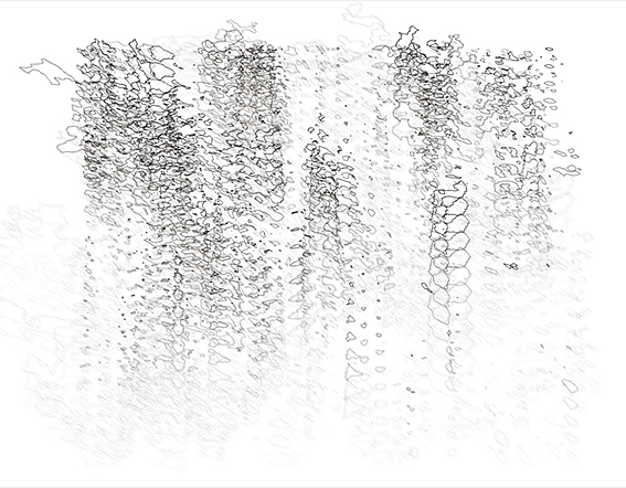
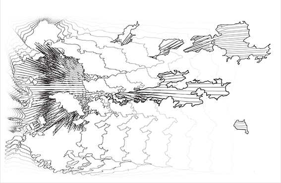
These are the questions which I engage in my work as a cartographer and artist. In terms of technique, visualizing real and interpreted urban data through Geographic Information Systems (GIS) I explore the reconstruction and dissection of territories through mapping extant political and cultural geographies in urban space and performing digital geographic transformations on them. The art I produce envisions the fluid interrelation of given isolated events and regions through continuums of connective vectors. The result is a digital texture where "places" blend synthetically with virtual "space" manifested through linework and colored assemblages. It's faintly real geography (although not privileging the original cartographic symbol), simulacra, and imagined territory all at once; an explicit mapping of invisible mental and projective geographies generated from the real.
Territories Amman (2009) series
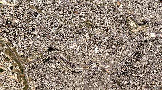
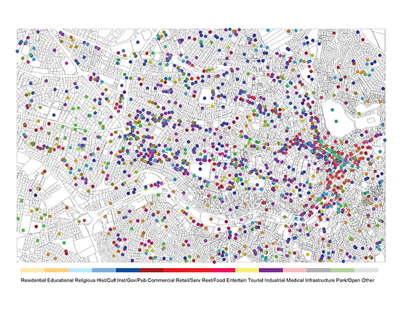
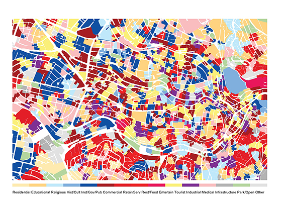
In Territories Amman, areal assemblages are constructed from the proximity of individual lots to their nearest land use activity geo-coded in a GIS point shapefile. These assemblages represent an expression of proximal influence by nearby human activity and certain territorial patterns emerge. Still, these assemblages form a patchwork of isolated areas whereas the projective mental and perceptive space of people inhabiting such areas likely constitutes an awareness which extends place beyond these delineated boundaries. This is the space I wish to capture.
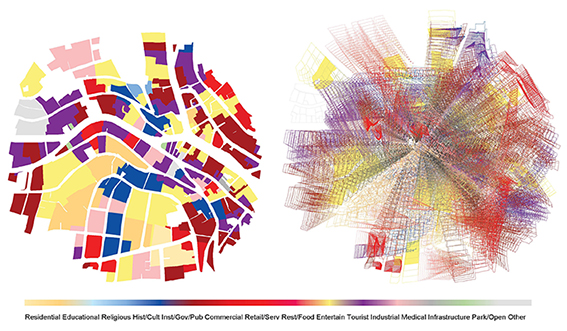
In a specific area of the patchwork, connective vectors stitch continuity among isolated use assemblages translated through a central locus. The resulting texture is a simulation or expression of the projective mental space that is invisible, yet pervasive in the connected experience between people, culture, activity, and the city.

In Jerusalem (2009) I explore a similar technique, this time inspired by an existing artwork by the artist Samia Halaby called Mountain Olives of Palestine (2003) (3), a memory and emotion map of Jerusalem constructed into a tapestry of acrylic-painted paper. Here, the colored and textured memory areas are interpreted and distorted to actual geographic places in the city according to an real map. Once again I construct continuous, connective vector tissues blending disparate areas through space and across place to suggest cultural connectivity despite actual in situ political fragmentation. An original, readable reference map is not retained in the work, but a trace of the analytical drawing process between map and memory is emphasized.
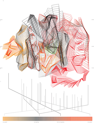
In a further analysis of the vector territories I’ve created, I take geographic sections of the linework, revealing the previous image as a 3-dimensional construct with an inherent landscape of suggestive, occupiable space. The rises and falls, and aggregations of lines correspond to specific vector conditions in the drawing indicating moments of intensity and tranquility in connection.

In the artwork I create, I’m less interested in the transmogrification of realistic representations into altered and interpreted versionings of the real. I attempt to simulate actionable and potentive forces embedded in what one could call the invisible territories of place, particularly in contexts where territorial boundaries are contested, fragmented, or disconnected from a larger cultural territory to which its inhabitants belong. There is a mental and emotional space which I attempt to delineate; an informal, internally known potential which binds events in space and place together in a nebulous and permeable field. In some cases, what I seek is a documentation of dissolution and dispersion in a quasi-temporal cartographic image – a sort of time-lapse, filmic capture of the dissolution of political or administrative boundaries and places of individuation towards the assemblage of continuous spatial territories. This practice, I would argue, deconstructs institutionalized political machinations in cartographic art; shifting the emphasis away from the administrative delineation of place to the structure and energy of the urban condition sustained by human activity.
Special thanks to Mario Gooden for inspiration and guidance.
Brian W. Brush, originally from Portland, Oregon, is an architect and educator who regards information as an instrumental material in architectural design. He is an Adjunct Assistant Professor of Architecture at Columbia University, teaching courses in Geographic Information Systems and assisting graduate design studios. Brian is also partner, with Yong Ju Lee, of E/B Office, an experimental digital design and fabrication practice based in New York and Portland.
Sources:
1) Katharine Harmon. The Map as Art: Contemporary Artists Explore Cartography. Princeton Architectural Press. New York. 2009.
2) Alexander J. Kent. “Aesthetics: A Lost Cause in Cartographic Theory.” The Cartographic Journal. Vol. 42 No.2. pp. 182-188. September 2005
3) Work by Samia Halaby http://www.art.net/~samia/


